
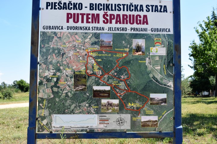

Name: Hiking path Prhati – stream Rakonik to Rasa
Place: Prhati – (Barban)
Coordinates: Starting point 45.08708 N – 14.01868 E, First cross point: 45.08708 N – 14.00196 E, splitting: 45.08744 N – 14.1131 E and end point 45.08672 N – 14.01646 E.
Name of church: St Margaretha from the 14th century.